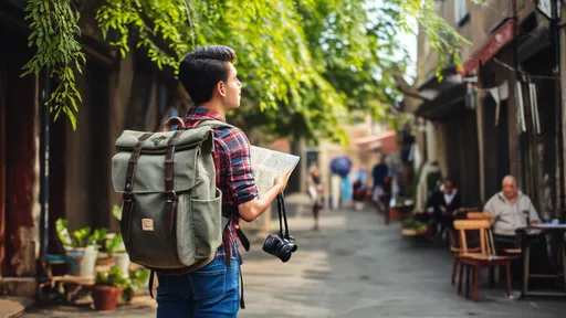
In the age of Instagram-worthy travel experiences, vacation rental photos have become increasingly sophisticated – and occasionally deceptive. The rise of "Airbnb catfishing," where properties appear dramatically different in reality than their listings suggest, has left many travelers seeking verification methods beyond curated images. One particularly effective technique gaining traction among savvy travelers involves using satellite imagery to investigate a property's true surroundings before booking.
The Deceptive Allure of Perfect Listings
Scroll through any vacation rental platform, and you'll encounter sun-drenched patios, sparkling pools, and charming neighborhood streets. What these carefully framed shots often exclude tells the real story: the active construction site next door, the highway overpass looming behind the property, or the industrial complex just beyond the cropped edges. Professional photographers (and clever smartphone users) know exactly how to manipulate angles and lighting to create idyllic scenes that may bear little resemblance to reality.
This phenomenon isn't limited to budget accommodations either. Even high-end rentals participate in what industry observers call "strategic framing." A luxurious villa might genuinely feature marble countertops and designer furniture as shown, while conveniently omitting the fact that it sits between a gas station and an all-night dance club. The resulting disappointment upon arrival has become such a common experience that travel forums now overflow with warnings about "too-good-to-be-true" listings.
Satellite Sleuthing: The Digital Age Travel Hack
Enter satellite imagery as the modern traveler's verification tool. Platforms like Google Earth, Apple Maps, and specialized services like Nearmap offer high-resolution overhead views that reveal what ground-level photos intentionally hide. These images provide unvarnished truth about a property's context within its environment, showing everything from proximity to undesirable landmarks to actual lot sizes that might differ from advertised dimensions.
The methodology proves surprisingly effective. Travelers can identify if that "secluded beachfront cottage" actually sits across a busy coastal road from the shore, or whether the "quiet countryside retreat" borders an active quarry. Satellite timestamps add another layer of verification – images taken during different seasons can reveal whether that "lush private garden" turns into a barren patch in winter, or if the "sparkling community pool" actually gets drained for half the year.
Reading Between the Pixels
Interpreting satellite images requires some practiced observation. Seasoned users look for specific telltale signs: parking lots near what's advertised as a "car-free pedestrian area," large commercial structures not mentioned in descriptions, or unexpected land features like steep hills that might make access difficult. The presence (or absence) of trees can indicate shade coverage during hot months, while roof conditions visible from above sometimes hint at property maintenance standards.
Resolution quality varies by location, with urban areas typically offering the clearest images. However, even slightly blurred rural images can provide crucial context about isolation levels or nearby agricultural operations that might generate odors or noise. Some travelers cross-reference satellite views with street-level imagery when available, creating a comprehensive understanding of the property's actual setting.
Beyond the Static Image
Advanced users take satellite verification further by examining historical imagery available on some platforms. This can reveal recent construction projects that might affect a property's appeal, or verify claims about recent renovations. The time-of-day feature on certain services even allows checking light exposure – valuable for determining if that "sunny balcony" actually sits in perpetual shadow from neighboring buildings.
Particularly diligent travelers combine satellite data with other digital tools. Checking flight paths on air traffic maps can explain missing mentions of airplane noise in listings near airports. Zoning maps available through municipal websites sometimes reveal permitted land uses around a property that photos carefully avoid showing. Together, these techniques form a powerful verification toolkit that goes far beyond trusting professionally staged photos.
The Ethical Considerations
This arms race between rental embellishment and renter verification raises questions about transparency in the sharing economy. While hosts argue they're simply presenting their properties in the best light (as hotels have always done), guests increasingly demand accurate representations rather than artistic ones. Some platforms have begun incorporating verification badges for listings where hosts provide unedited exterior photos, but adoption remains spotty.
Privacy concerns also emerge when discussing satellite verification. While all imagery discussed comes from publicly available sources, the practice does represent a new level of guest due diligence that some hosts find uncomfortably invasive. This tension between reasonable research and perceived overreach continues evolving as technology provides ever-more sophisticated ways to scrutinize listings before arrival.
The Future of Rental Verification
As satellite technology improves and refresh rates increase, real-time verification may become possible. Startups are already experimenting with AI that cross-references listing photos with satellite data to flag potential discrepancies automatically. Some industry watchers predict future rental platforms might integrate these tools directly into their interfaces, allowing travelers to toggle between professional photos and raw geographic data seamlessly.
For now, satellite sleuthing remains a powerful weapon in the savvy traveler's arsenal against misleading listings. While it can't replace on-the-ground reviews or replace human judgment, this space-age technique adds a valuable dimension to trip planning. Those extra minutes spent examining pixels might mean the difference between arriving at a dream getaway or an expensive disappointment – making digital cartography an unexpected essential skill for modern travelers.

By /Aug 22, 2025

By /Aug 22, 2025

By /Aug 22, 2025

By /Aug 13, 2025

By /Aug 13, 2025

By /Aug 13, 2025

By /Aug 13, 2025

By /Aug 13, 2025

By /Aug 13, 2025

By /Aug 13, 2025

By /Aug 13, 2025

By /Aug 13, 2025

By /Aug 13, 2025

By /Aug 13, 2025

By /Aug 13, 2025

By /Aug 13, 2025

By /Aug 13, 2025

By /Aug 13, 2025

By /Aug 13, 2025

By /Aug 13, 2025